Birmingham City Council
Tree preservation zone
There is a problem
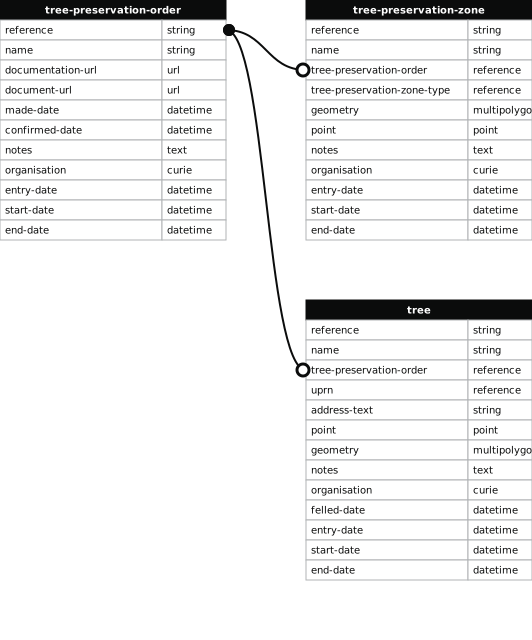
- 1000 entries with tree-preservation-order field must match the reference field in the tree preservation order dataset
THE BIRMINGHAM (LAND AT RIDGACRE ROAD CORNER OF HIGHFIELD LANE, QUINTON) TPO 1999
- reference
- 831
- name
- THE BIRMINGHAM (LAND AT RIDGACRE ROAD CORNER OF HIGHFIELD LANE, QUINTON) TPO 1999
- tree-preservation-order
- TPO 831
- tree-preservation-zone-type
- area
- geometry
- MULTIPOLYGON (((-2.003767 52.458531,-2.003900 52.458667,-2.003802 52.458708,-2.003654 52.458784,-2.003630 52.458793,-2.003567 52.458827,-2.003465 52.458873,-2.003434 52.458889,-2.003419 52.458903,-2.003437 52.458916,-2.003459 52.458925,-2.003513 52.458936,-2.003539 52.458946,-2.003667 52.458977,-2.003712 52.458986,-2.003761 52.458991,-2.003849 52.458994,-2.003939 52.458991,-2.004209 52.458954,-2.004235 52.458953,-2.004107 52.458586,-2.004430 52.458471,-2.004412 52.458447,-2.004337 52.458357,-2.004239 52.458387,-2.004130 52.458418,-2.003767 52.458531)))
- point
- POINT (-2.003958 52.458731)
- notes
- The shaded area represents those properties which fall within the outline of a Tree Preservation Order. To precisely identify trees protected by the Order, you can request a copy of the tree preservation order at the following link.
- entry-date
- 2026-10-15
- start-date
- end-date
How to fix this issue
Your data is missing a tree-preservation-order.
The tree preservation zone guidance explains how to fix the issue:
tree-preservation-order
The reference for the tree preservation order that covers this zone.
How to improve Birmingham City Council’s data
- Fix the errors indicated
- Use the check service to make sure the data meets the standard
- Publish the updated data on the endpoint URL